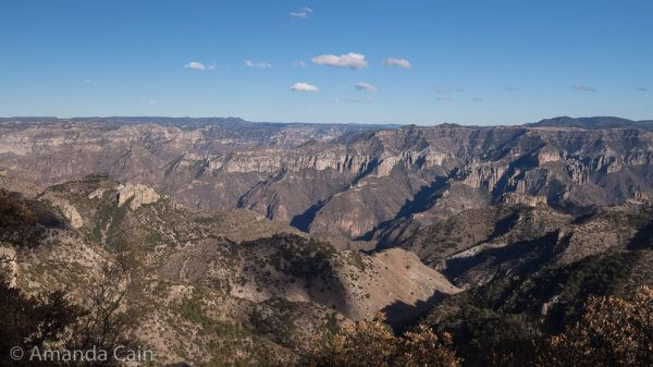
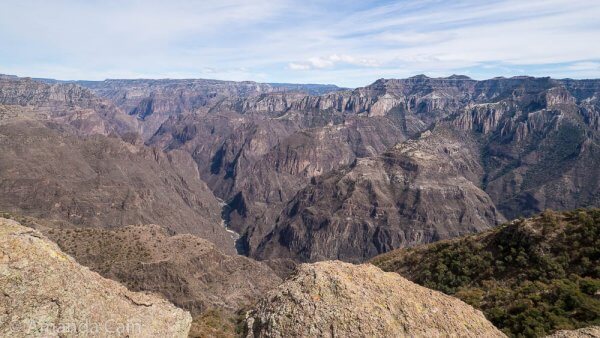
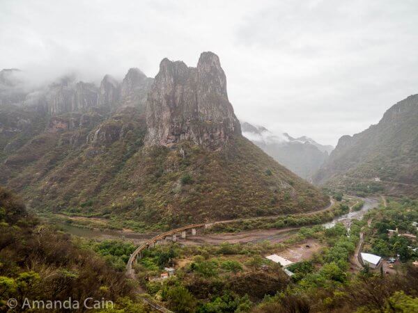
Pretty much everyone has heard of the Grand Canyon in the United States. In Mexico they have their own big and impressive canyon: Copper Canyon. It’s actually deeper and covers a bigger area than the Grand Canyon. And like the Grand Canyon, it has some very dramatic canyon scenery.
El Chepe
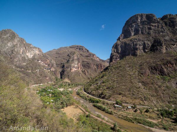
To get to Copper Canyon the nicest option is to take the scenic train, “El Chepe”, which runs along the canyon. You see some beautiful scenery along the way as the train winds its way along the side of the canyon up towards the rim.
You can also open the top half of the carriage doors (to make an open window) so you can hang out the side of the train taking photos. Pretty much every door had two people hanging out the side with their cameras. Just don’t stick your head out too far in case of tunnels and trees.
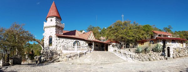
Posada Barrancas
There’s plenty of small towns you can stop off at along the way to see various things. But we stayed on the train until we got to the central section of the canyon at Posada Barrancas (which also has a castle).
The main thing that attracted us to this spot was the Adventure Park. Where you can take a series of zip lines along the ridges of the canyon out to a viewpoint far out in the middle of the canyon. Or you could take the world’s longest zip line (2.5km long!) all the way to the viewpoint. Or you could take a cable car. Sounded pretty cool. Unfortunately the cable car and ziplines were closed for maintenance while we were there. That’ll teach us to go do things in low season.
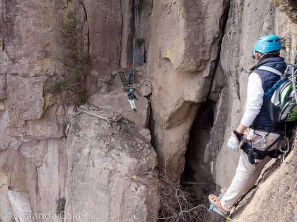
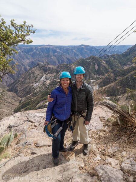
Via Ferrata
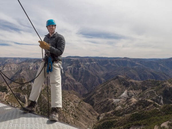
The Adventure Park still had a few attractions open, and we figured that we’d come all this way so we did the via ferrata. This is a bit like a high ropes course, except you do it along the side of a cliff. It was pretty fun, and you got some great views of the canyon as you went along.
We Didn’t Come All This Way Not to See the View
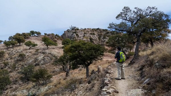
We decided that since we had come all this way, only for all the ziplines and cable car to be closed, that we were going to hike out to the viewpoint ourselves. There’s a few different hikes you can take out to the viewpoint. And if you’re hardcore enough you can ride a mountain bike on the paths.
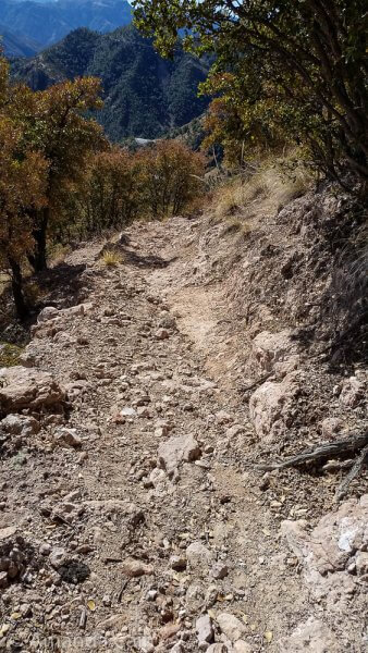
We decided to go with the two feet option. It took us about 4 hours to make it out there and, like hiking the Inca Trail, the end didn’t really seem to get any closer.
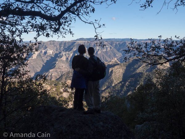
But when we made it there the view was definitely worth it.
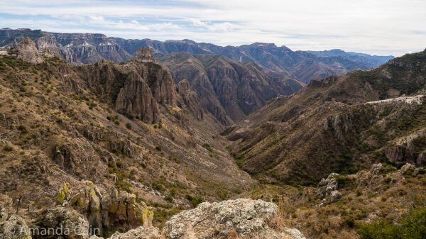
What made it extra special was the fact that, since most of the Adventure Park was closed, we were the only people there to enjoy the view. No selfie sticks, or people trying to sell you crap. Just peace and quiet and an incredible view all to yourself. You could really feel the emptiness and vastness of the canyon.
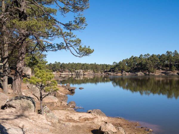
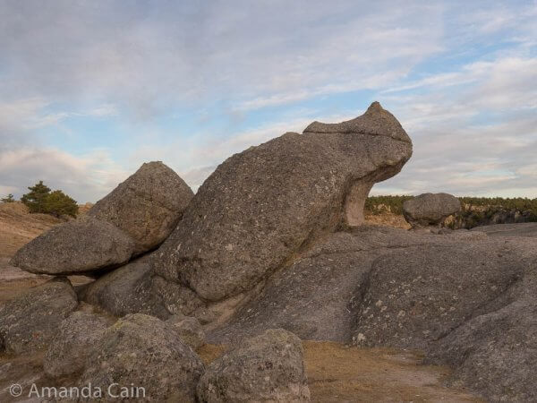
Creel
After our hike it was back on the train to our next stop: Creel. This town is near the start of Copper Canyon, so you have some more canyon views as well as interesting rock formations. You can ride bikes to all the rock formations since they’re nearby. But you need motorised transport if you want to see the canyon. Since we weren’t interested in driving and had no idea how to ride a scooter, we hired a crazy local guide called Gustavo to show us around.
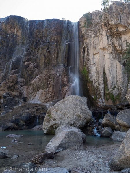
Waterfalls and Rivers in the Dry Season
All along the way to the bottom of the canyon we kept stopping at water features that eventually make their way to the Urique River. This river has carved out the canyon over millions of years. Since we were travelling in the dry (low) season, the rivers and waterfalls were a little less than impressive. So it was a bit hard to see how the river could erode the rocks to form the canyon.
Gustavo was honest and told us that it wasn’t going to be that great this time of year. But he kept us entertained on the long drive by telling us stories like how his mum was only 10 minutes away from where the Mexican Marines caught El Chapo after he broke out of prison. And that she didn’t think anything strange was going on at first, even though there were navy helicopters circling the area and military vehicles in the streets.
He also told us that if we saw any bright green patches of land in the canyon then it was probably marijuana or opium plantations. (Plantation visits and sampling were not included in our tour.) And that Pedr should be careful where he pointed his binoculars. (Kidding!) But he did reassure us that as long as we stayed in the tourist areas then drug cartels weren’t going to be a problem.
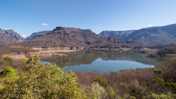
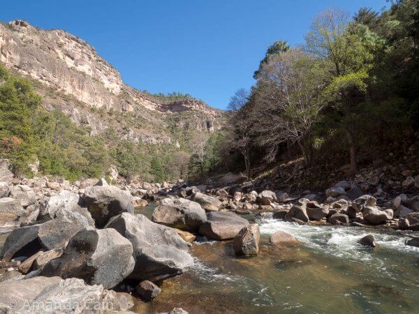
Down to the Bottom of Copper Canyon
We eventually made it to the bottom of the canyon and could touch the Urique River. It’s a lot easier when the canyon’s not as deep as it is at Posada Barrancas.
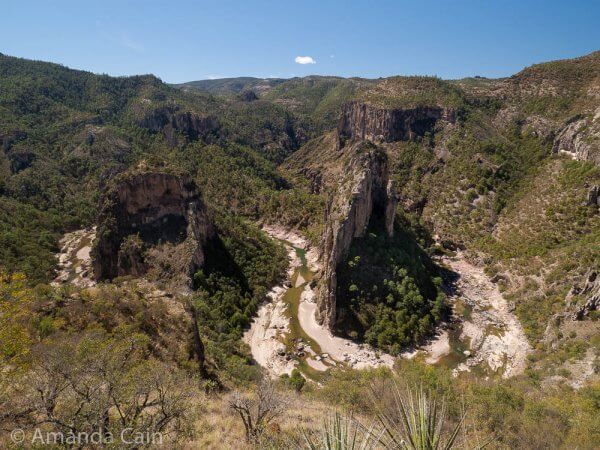
Just up the road from this point was the Double Horseshoe. A dramatic formation where the river has carved out the rocks and left behind two giant pillars of stone.
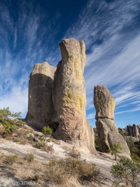
Valley of the Monks
After our trip down to the bottom of the canyon it was time to head back up towards Creel to the rock formations. The most impressive is the Valley of the Monks with these big pillars of stone sticking straight up into the sky.
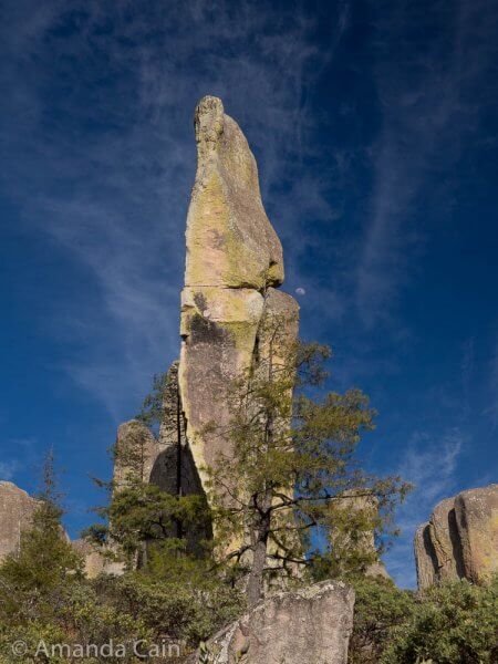
There must be at least one hundred of them there. Some clustered together, others standing on their own. “Valley of the Monks” is the Spanish name, the local Raramuri people call it “The Valley of Penises”. I’ll let you make up your own mind on what to call it.
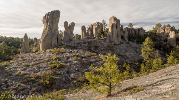
For some reason it’s not that popular because the Valley of the Frogs and Mushrooms is closer to town, and people just ride bikes and quadbikes there and turn back again. So while we were there we had the whole place to ourselves. With the soft late afternoon light it became an almost mystical place.
Back out of Copper Canyon
After our week in Copper Canyon it was time for us to get back on the train and head back. It was a cold grey rainy day when we left. So we were very happy we got lucky with the weather.
If you’re thinking of going to Copper Canyon, then February is the coldest month of the year. And it gets very cold at night. While we were in Creel I slept in my hiking pants and puffy jacket because it was so cold at night. And no we weren’t in a tent. In Posada Barrancas we had our own wood stove, and we failed again at basic survival. We had to get the owner to come light our fire every night. On the first night they filled our firewood box with enough wood to last three nights. We burnt it all in the first night. If we are ever in a situation where we need fire to survive, we will probably die.
Leave a Reply